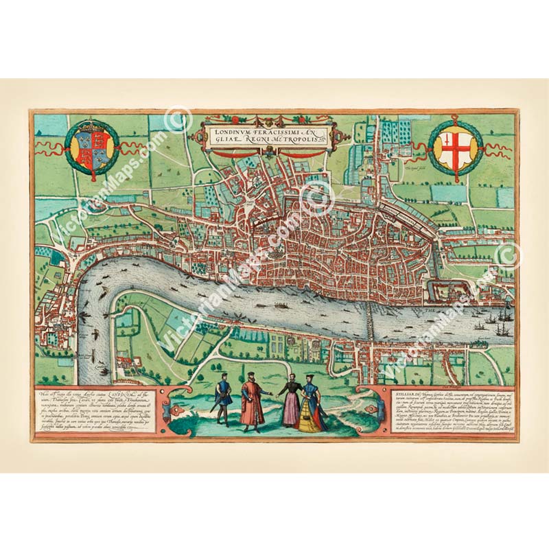
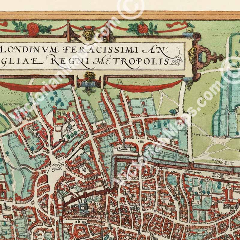
"Londinum Feracissimi Angliae Regni Metropolis" - a famous bird's-eye view map of London by George Braun & Frans Hogenberg, engraved and hand-coloured, published in 1st volume of their atlas of city views "Civitates Orbis Terrarium" in Cologne and Amsterdam in 1572.
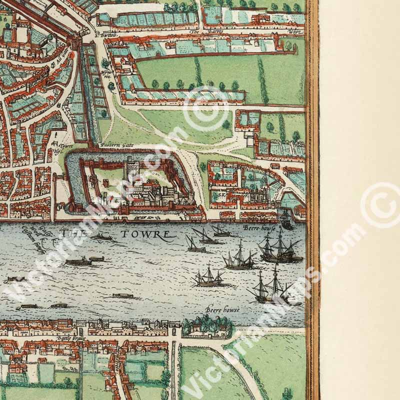
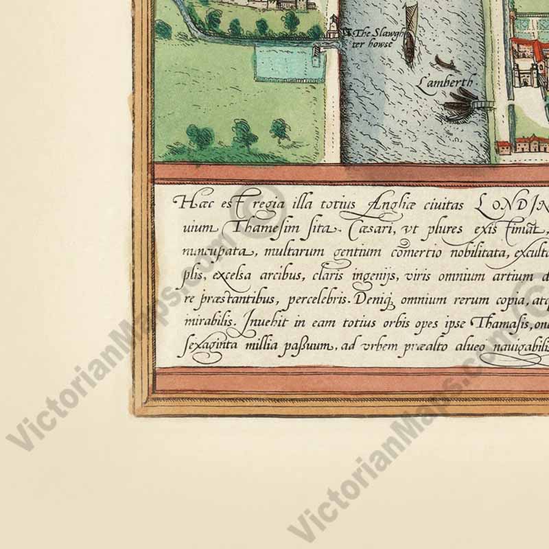
The Londinum Feracissimi Angliae Regni Metropolis map was based on so-called "Copperplate map of London", a now-lost twenty-sheet large plan of London believed to have been made between 1553 and 1559. It is the earliest true map of London (as opposed to panoramic views). Tudor London with its suburbs now extends outside the city walls. At the heart of the city is St. Paul's cathedral with its tall spire, which was lost in a fire in 1561. The gardens of the manor houses and palaces stretch out in the direction of Charing Cross, linking the city with the royal court at Westminster. Across the Thames, spanned by the magnificent London Bridge, Southwark is depicted along with the bull/bear baiting rings, very popular sports during the Elizabethan era. The river Thames is busy with ships and boats.
Georg Braun (1541 – 1622) was a topo-geographer. From 1572 to 1617 he edited the Civitates orbis terrarum, which contains 546 prospects, bird's-eye views and maps of cities from all around the world. He was the principal editor of the work. Braun was born and died in Cologne. His principal profession was as a Catholic cleric. His six-volume work was inspired by Sebastian Münster's Cosmographia. The Braun publication set new standards in cartography for over 100 years.
Frans Hogenberg (1535–1590) was a Flemish and German painter, engraver, and mapmaker. Hogenberg was born in Mechelen. In 1568 he was banned from Antwerp by the Duke of Alva and travelled to London, where he stayed a few years before emigrating to Cologne. He is known for portraits and topographical views as well as historical allegories. He created the tables for Civitates orbis terrarum volumes I through IV.
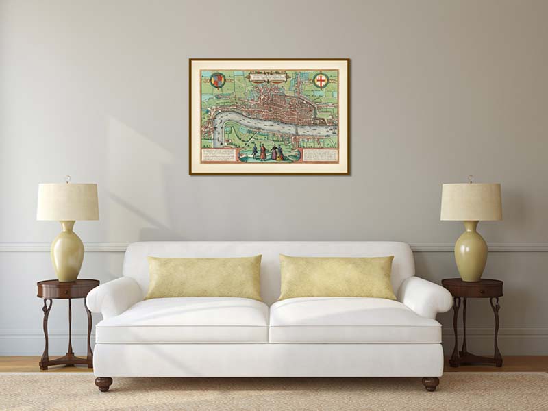
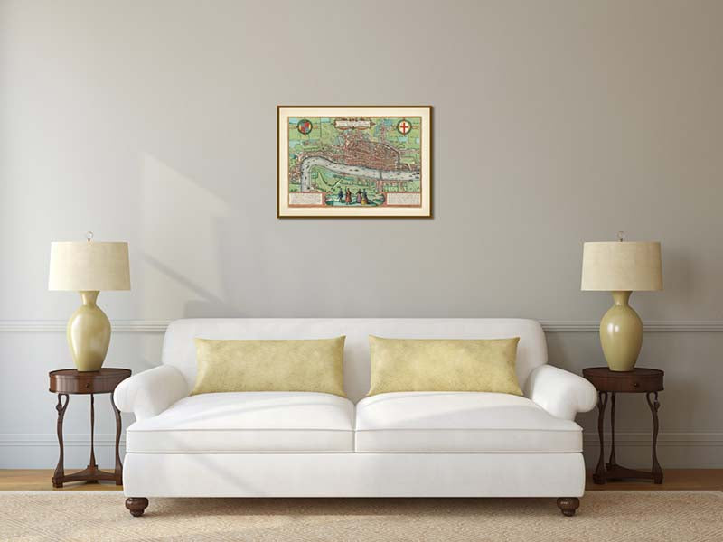
This poster is a high quality "giclée" reproduction of a restored antique original, custom-printed on Standard Single-weight Matt Coated art paper 140gsm or Heavyweight Matt Coated art paper 230gsm (more of a thin card density), or superb Epson Matt Canvas 320gsm, according to your choice. We use the latest UltraChromeHDX pigment inks which guarantee 60 years of colour permanence (up to 200 years fade-proof for colour prints). This poster is suitable for mounting and framing, as well as direct display on a wall.
This high-resolution, museum-grade fine art print is produced from a unique restored image. Printed on premium archival-quality art paper or canvas, it makes a striking addition to any interior as wall décor or a poster, and a memorable gift for lovers of antique and vintage maps, collectors of historic prints, historians, and explorers. Almost indistinguishable from the original Tudor period engraving, it adds character and interest to a study, library, or office wall. It also makes a thoughtful gift for all occasions, including Christmas, Valentine's Day, Easter, and Father's or Mother's Day.